
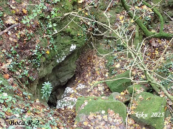
Cova de R-6) R-5 R-4 R3 Rotgers (r-2
Gypsum cave with 1089 metres of passage and 76 metres of vertical extent in the municipality of Borredà, with entrances R-1 to R-6, superimposed galleries, meanders and chambers such as the Sala de R-2 and the Sala blanca.
EspeleoWorld
Cova de R-6) R-5 R-4 R3 Rotgers (r-2
Gypsum cave with 1089 metres of passage and 76 metres of vertical extent in the municipality of Borredà, with entrances R-1 to R-6, superimposed galleries, meanders and chambers such as the Sala de R-2 and the Sala blanca.
Borredà · Berguedà
Sviluppo: 1089 m · Profondità: 76 m
Scheda aggiornata
https://espeleoworld.com/it/c/cova-de-rotgers-r2-i-r3
Le informazioni possono cambiare. Verifica sempre coordinate, accesso, meteo e condizioni della cavità prima di partire.
Gypsum cave with 1089 metres of passage and 76 metres of vertical extent in the municipality of Borredà, with entrances R-1 to R-6, superimposed galleries, meanders and chambers such as the Sala de R-2 and the Sala blanca.
Topografia
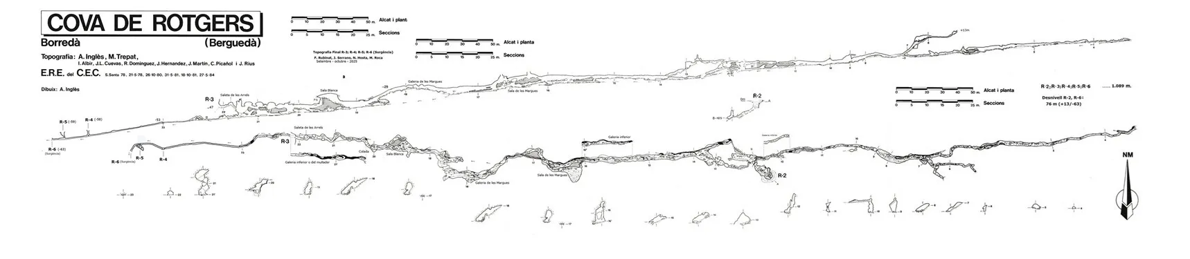
Espeleoindex · CC BY-NC 4.0, https://creativecommons.org/licenses/by-nc/4.0/ · Immagine © del suo autore.
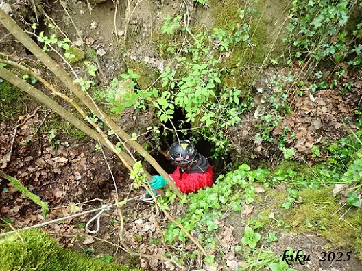
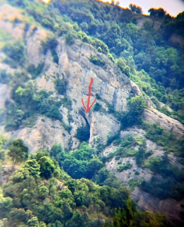
Foto
Espeleoindex · CC BY-NC 4.0, https://creativecommons.org/licenses/by-nc/4.0/ · Immagine © del suo autore.
Descrizione
Morfologia
Entering through the R-2 entrance, after descending 10 metres among blocks and passing a wet flat-out squeeze, one reaches a chamber called the Sala de R-2.
From here, if we choose to advance ascending towards the east, in an upward direction, the cavity presents a first sector of 45 metres with two superimposed galleries that are not very wide, although only the lower one is fully passable. A sector follows where one advances comfortably until reaching a fork on the right from which narrow, muddy ascending conduits emerge with 16 metres of vertical extent and which end at the +13m level, this being the highest point of the cave. To continue along the main gallery one must pass a very narrow crawl, the main gallery continues until it becomes impassable at the +8m level relative to the R-2 entrance, which is where the 0 level of the Rotgers cave is located (R-2, R-3, R-4, R-5, R-6).
If we follow downstream in a westerly direction, descending, that is towards R-3, the water that comes from the ascending gallery of R-2 and from its entrance is lost in a gallery that becomes impenetrable within a few metres. The valid passage is found near the ceiling of the Sala de R-2 where a small hole links with a meander of very reduced dimensions.
A series of narrow passages and small chambers lead us to find the water again in the main gallery. Below this gallery there is another one, through which the stream eventually flows.
The lower gallery, where one can descend at different points, rejoins the upper route after passing below the Sala de les Margues.
On starting the Galeria de les Margues with a width between 4 and 10 metres, we again lose sight of the water, which we find again at the end of its 50 metres of passage and before entering the Sala blanca. This chamber of 7x16 metres is strongly ascending and has at its highest end the entrance of a 5-metre pitch, this is currently rigged with a fixed rope with knots. Below the chamber is the active gallery through which the water flows, although, in its very middle, a narrow section bars our way.
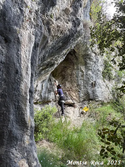
After passing La Colada, a reddish concretion that we find on the left, we reach a new sector of double gallery of 50 metres. Along the lower level, we follow the watercourse and cross small pools. The upper floor can be reached at different points and thanks to simple scrambles. The last of these, rigged with a fixed rope, gives access to the saleta de les Arrels, where the draught of air entering or leaving through the nearby R-3 entrance is already clearly noticeable, this is rigged with staples to facilitate the exit access.
Below, the gallery continues for more than 50 metres to a narrow wet flat-out squeeze, from here some 25 metres follow through a narrow crawl with water where we find only one point where we can stand up, immediately after there is a passage where one must put one's head in the water, and some 25 metres further on one reaches the base of the access pitch of the R-4 entrance, the gallery continues until reaching the base of the access pitch of the R-5 entrance, and continuing a few metres further on one reaches the R-6 entrance, which is the spring of the cave. This entire route is done in the water, so it is advisable to do it with a wetsuit, since the water is quite cold even in summer.
The total passage is 1089 metres, while the vertical extent is 76 metres (+13/-63). The zero level corresponds to the R-2 entrance.
Concrezioni
After passing La Colada, a reddish concretion that we find on the left, we reach a new sector of double gallery of 50 metres.
Idrologia
Inside the R-2 gallery at this point we find the first water input, since further on in the ascending direction we no longer find any more.
Altri dettagli
NOTE: It is evident that since the explorations carried out in the late 70s and early 80s of the last century, more than forty years have passed; in this short period of time the waters that flow in the last 100 metres of the cave have had the capacity to erode the material, in this case gypsum, to the point of allowing the passage of people, which was impossible in the first explorations, not even the spring was accessible.
In order to do the traverse between R-3 and R-6, it is convenient to first go and look at the volume of water emerging from the spring, since a stretch of the gallery ends up sumping when it carries too much water.
As for the ascending gallery of +13 metres, at this point remains of plastic have been found that we think come from the surface, since this point is 3 metres from the surface in the middle of the track that leads to Sant Sadurní de Rotgers at the coordinates (UTM ETRS89 415363-4667470 and 967 masl), but just at this point of the track some time ago work was done to channel the rainwater coming from the upper meadows, placing a concrete base and large tubes of the same material that make unblocking unviable.
To the west of the doline where the Rotgers cave (R-1) opens and near the track we find another doline where the water of a torrent ends up when it rains; at the bottom of the doline there is a fissure through which the water is lost, but the passage is quite narrow. This doline lies vertically above the R-2 gallery, some 60 metres before the end of that gallery and a vertical extent of 13 metres, coordinates (UTM ETRS89 415389-4667491 and 973 masl). Inside the R-2 gallery at this point we find the first water input, since further on in the ascending direction we no longer find any more.
It has also been concluded that there is no possibility of a connection between the Coves de Rotgers (R-1) and (R-2), since the closest point of R-2 with respect to R-1 is 23 metres away in a SW direction, and, more decisively, the final point of R-2 in the direction of R-1 is +8 metres in height above the final level of R-1, for which reason communication between both cavities is not seen as feasible.
Storia
On 2 March 1969 Montserrat Ubach located R-1 thanks to the indications of the residents of Borredà. A long series of explorations began (up to 15) that allowed the ERE to explore and survey every last corner of the cavity. On 1 May 1969 R-2 and R-3 were found and on 15 August of the same year the two cavities were connected. In 1977 members of the SIS of the CE Terrassa carried out a new survey giving it 920 metres. In 1978 a team of the ERE began the making of a new survey that would be completed in five sessions between 1980 and 1984, the passage of the system was established at 1014 metres with a vertical extent of 67 metres (+13/-54).
In 2025 Juli Serrano, Montse Roca (SIE-CEA), Francesc Rubinat (ERE-CEC), and Nil Hosta carried out a survey revision of the cavity, as well as various unblockings starting from R-3, which led to locating the entrances of R-4, R-5 and R-6 (spring), managing to do the traverse of the whole cavity. The current passage is 1089 metres and the vertical extent 76 metres (+13/-63).
Commenti degli utenti (0)
Nessun commento ancora.
Sii il primo a condividere la tua esperienza!
Esplorazioni registrate (0)
Nessuna esplorazione registrata.
Registra la tua visita a questa grotta!
Bibliografia
Ubach, M. (1972).-'La primera exploració de Rotgers'. Espeleòleg (16):809-810 ERE-CEC. Barcelona.
Noguera M.; Germain, J. (1978).-'El Sistema de Rotgers'. SIS (6):25-29. SIS-CE Terrassa.
Inglès i Alcon, Antoni.(1991).-'La Cova de Rotgers: Una 'clàssica' excavada en guixos'. Espeleòleg (39):38-42. ERE - CE Catalunya. Barcelona.
Valles, Jordi de (2009).-'Berguedà, Cerdanya, Garrotxa i Ripollès'. Catàleg Espeleològic de Catalunya (vol.3): 1-381. E C Gràcia/FCE
Revisió topogràfica, dades, coordenades i fotografies, facilitades per Juli Serrano, Montse Roca, Francesc Rubinat, Nil Hosta, Arcadia Cabanas i Tanit Sanmartin. Gener de 2026.
Grotte vicine


Fonte: Espeleoindex (espeleoindex.com), modificato. CC BY-NC 4.0, https://creativecommons.org/licenses/by-nc/4.0/