
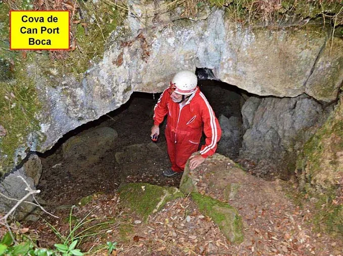
Cova de Can Port
A 75 m long cave west of the Estany de Banyoles, with clastic morphology and concretion-covered sections.
EspeleoWorld
Cova de Can Port
A 75 m long cave west of the Estany de Banyoles, with clastic morphology and concretion-covered sections.
Porqueres · Pla de l'Estany
Sviluppo: 75 m · Profondità: 14 m
Scheda aggiornata
https://espeleoworld.com/it/c/cova-de-can-port
Le informazioni possono cambiare. Verifica sempre coordinate, accesso, meteo e condizioni della cavità prima di partire.
A 75 m long cave west of the Estany de Banyoles, with clastic morphology and concretion-covered sections.
Topografia
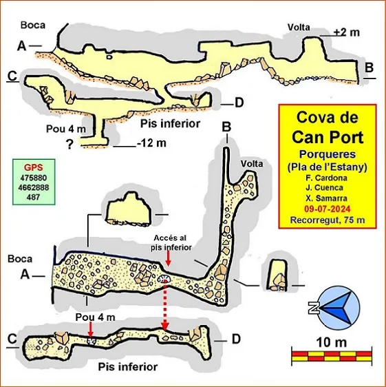

Espeleoindex · CC BY-NC 4.0, https://creativecommons.org/licenses/by-nc/4.0/ · Immagine © del suo autore.
Foto

Espeleoindex · CC BY-NC 4.0, https://creativecommons.org/licenses/by-nc/4.0/ · Immagine © del suo autore.
Descrizione
Morfologia
The entrance opens onto a small slope with a small flat area in front; it is 3 m wide by 1 m high. It gives access to the main gallery, with an average width of 4 m and a height that in some places exceeds 5 m. At 16 m from the entrance a hole opens in the floor that will allow us to reach the lower level. A few metres further on, the cave makes a sharp 90 degree turn to the left. The new gallery has a smaller cross-section, with many blocks, some of good size, and with uneven ground. At its end it bifurcates: straight ahead a fairly narrow joint-controlled gallery continues, while to the right we can climb 5 m among blocks up a fairly vertical gallery in the manner of a vault.
The gallery of the lower level is relatively narrow but we can walk upright in much of it. We must pass over the mouth of a narrow shaft 4 m deep; at its bottom the highest point of the cave is reached, -12 m, and the beginning of a narrow crawlway can be guessed at, which we have not entered. The lower level ends in a slight upward widening closed by a vault that cannot be far from the outside surface.
The dominant morphology of the cave is clastic, but we also find sections with heavily concretion-covered walls, especially around the point where the cave makes the 90 degree turn.
Storia
Known by some people of the area and local hikers, but unpublished speleologically, not appearing in any catalogue despite some relatively recent antecedents of bibliographic reviews in some local publications. Curiously, it should be said that its name appears lettered on the map of Editorial Alpina: Garrotxa, since fairly old editions.
Commenti degli utenti (0)
Nessun commento ancora.
Sii il primo a condividere la tua esperienza!
Esplorazioni registrate (0)
Nessuna esplorazione registrata.
Registra la tua visita a questa grotta!
Bibliografia
Totes les dades, topografia i fotografies han estat extretes del web: geb.cat (del Grup d'Espeleleologia de Badalona). Apunt del 15-7-2024. Dades; Ferran Cardona (ECM Barcelonès) i Josep Cuenca, Xavier Samarra, Francesc Miret (GE Badalona)
Grotte vicine

les Estunes
3.2 km · E
Porqueres (Pla de l'Estany)
1 topo.7 foto

Avenc de Can Plana
5.2 km · SO
Sant Martí de Llémena (Gironès)
2 topo.5 foto
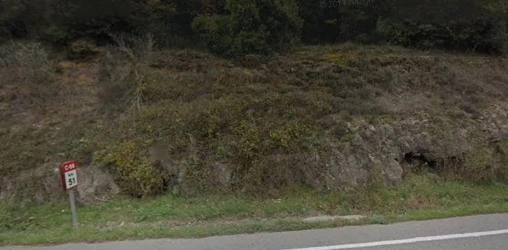
Bora de la Carretera
5.5 km · NE
Serinyà (Pla de l'Estany)
1 topo.1 foto

Cova de Ventatjol
5.7 km · NO
Sant Miquel de Campmajor (Pla de l'Estany)
1 topo.7 foto
Fonte: Espeleoindex (espeleoindex.com), modificato. CC BY-NC 4.0, https://creativecommons.org/licenses/by-nc/4.0/