

Cova Boca de Drac
A nice rock shelter in the barranc de la Vall, Montblanc, known among hikers for a long time.
EspeleoWorld
Cova Boca de Drac
A nice rock shelter in the barranc de la Vall, Montblanc, known among hikers for a long time.
Montblanc · Conca de Barberà
Sviluppo: 19 m · Profondità: 2 m
Scheda aggiornata
https://espeleoworld.com/it/c/cova-boca-de-drac
Le informazioni possono cambiare. Verifica sempre coordinate, accesso, meteo e condizioni della cavità prima di partire.
A nice rock shelter in the barranc de la Vall, Montblanc, known among hikers for a long time.
Topografia


Espeleoindex · CC BY-NC 4.0, https://creativecommons.org/licenses/by-nc/4.0/ · Immagine © del suo autore.
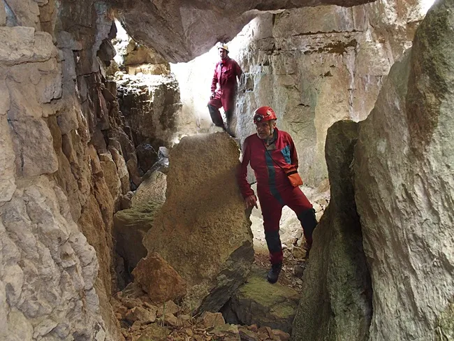
Foto

Espeleoindex · CC BY-NC 4.0, https://creativecommons.org/licenses/by-nc/4.0/ · Immagine © del suo autore.
Descrizione
Morfologia
A wide mouth gives access to the rock shelter on its S side. On the front of the rock shelter two walls of travertine and formation have formed that partly close it and from a distance, with much imagination, give it an appearance similar to a dragon's mouth. The route is 19 metres.
Storia
Known among hikers for a long time.
Commenti degli utenti (0)
Nessun commento ancora.
Sii il primo a condividere la tua esperienza!
Esplorazioni registrate (0)
Nessuna esplorazione registrata.
Registra la tua visita a questa grotta!
Bibliografia
Dades, coordenades, topografia i fotos facilitades per Juli, Serrano i Montse Roca (SIE-CEA) amb Francesc Rubinat (ERE-CEC).
Grotte vicine

Avenc Gran de Esquerdes de les - Rojalons Venes
1.7 km · SE
Montblanc (Conca de Barberà)
2 topo.12 foto

Avenc Montse Travé
2.1 km · S
Montblanc (Conca de Barberà)
2 topo.6 foto
Túnel de Cantacorbs
2.1 km · S
Montblanc (Conca de Barberà)
2 topo.3 foto

Esquerda Gran de Cantacorbs
2.2 km · S
Montblanc (Conca de Barberà)
2 topo.5 foto
Fonte: Espeleoindex (espeleoindex.com), modificato. CC BY-NC 4.0, https://creativecommons.org/licenses/by-nc/4.0/