

Balmes de les Puelles
A group of small rock shelters at the balmes de les Puelles, possibly once inhabited, with medieval remains and an engraving from 1938.
EspeleoWorld
Balmes de les Puelles
A group of small rock shelters at the balmes de les Puelles, possibly once inhabited, with medieval remains and an engraving from 1938.
Agramunt · Urgell
Sviluppo: 5 m
Scheda aggiornata
https://espeleoworld.com/it/c/balmes-de-les-puelles
Le informazioni possono cambiare. Verifica sempre coordinate, accesso, meteo e condizioni della cavità prima di partire.
A group of small rock shelters at the balmes de les Puelles, possibly once inhabited, with medieval remains and an engraving from 1938.
Topografia

Espeleoindex · CC BY-NC 4.0, https://creativecommons.org/licenses/by-nc/4.0/ · Immagine © del suo autore.
Foto
Espeleoindex · CC BY-NC 4.0, https://creativecommons.org/licenses/by-nc/4.0/ · Immagine © del suo autore.
Descrizione
Morfologia
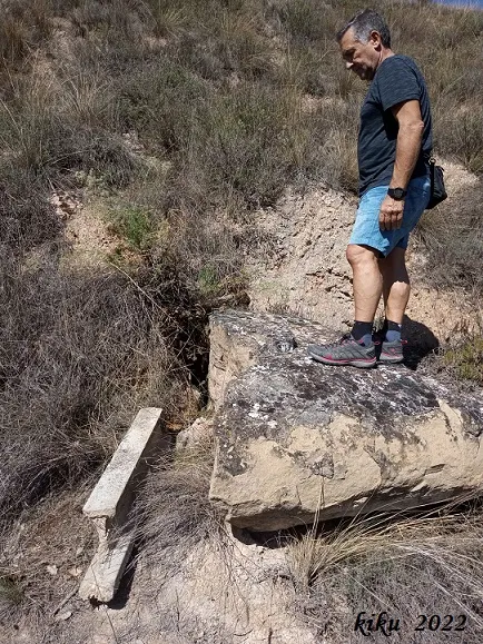
Rock shelter no. 1 de les Puelles: a small rock shelter measuring 11 metres wide and 1.5 metres high at most. The overhang is irregular; two large blocks fallen from the ceiling occupy part of the floor of the cavity. It has a small stone wall between the blocks.
Rock shelter no. 2 de les Puelles: rock shelters numbers 2 and 3 are located beneath rock overhangs produced by the erosion and dissolution of the soft earth and rock of the lower part, which has left these hollows in the crag. It is a small cavity, with a flat floor, 25 metres wide, which we consider to be quite considerable given the terrain in which it is excavated and the geography of the region where it is located.
Rock shelter no. 3 de les Puelles: it has a flat floor and also a considerable width of 24 metres.
Coveta de les Puelles: a small cavern of short extent (1.5 m). Beside the entrance, which is just over one metre high, there is an engraving made with a pointed object on which one reads “Año 1938”.
Idrologia
A few metres from the small cave is the so-called Bassa del Roc, an old large basin built beneath a rock, with all its walls of dry stone. For 400 years it supplied water to the village of les Puelles, until the beginning of the 20th century.
Storia
Known since ancient times, remains from the Medieval period (400 / 1492) have been found.
The date of the engraving, “Año 1938”, evokes the year of the civil war in which Agramunt suffered air attacks and people sought refuge in these caves.
Commenti degli utenti (0)
Nessun commento ancora.
Sii il primo a condividere la tua esperienza!
Esplorazioni registrate (0)
Nessuna esplorazione registrata.
Registra la tua visita a questa grotta!
Bibliografia
- Valles, Jordi de (2008).-”Alt Urgell, Noguera, Pla d'Urgell, Segarra, Solsonès, Urgell”. Catàleg Espeleològic de Catalunya (vol.2):1-384. ECG/FCE.
- Actualització de les dades, topografies i fotografies extretes del blog: cavitatsdecatalunya.blogspot (de Jordi de Valles). Apunt del 26-4-2022.
Grotte vicine


Fonte: Espeleoindex (espeleoindex.com), modificato. CC BY-NC 4.0, https://creativecommons.org/licenses/by-nc/4.0/