
Avenc Miravet
A 43-metre-deep pit in Miravet (Ribera d'Ebre), with two exploration routes and a western sector of joints and secondary fractures.
EspeleoWorld
Avenc Miravet
A 43-metre-deep pit in Miravet (Ribera d'Ebre), with two exploration routes and a western sector of joints and secondary fractures.
Miravet · Ribera d'Ebre
Sviluppo: 283 m · Profondità: 43 m
Scheda aggiornata
https://espeleoworld.com/it/c/avenc-miravet
Le informazioni possono cambiare. Verifica sempre coordinate, accesso, meteo e condizioni della cavità prima di partire.
A 43-metre-deep pit in Miravet (Ribera d'Ebre), with two exploration routes and a western sector of joints and secondary fractures.
Topografia
Espeleoindex · CC BY-NC 4.0, https://creativecommons.org/licenses/by-nc/4.0/ · Immagine © del suo autore.
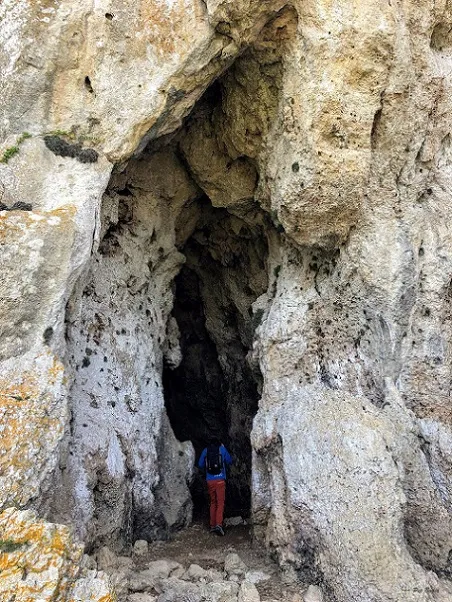
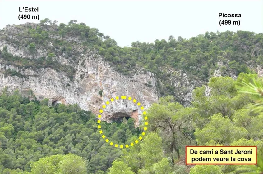
Foto
Espeleoindex · CC BY-NC 4.0, https://creativecommons.org/licenses/by-nc/4.0/ · Immagine © del suo autore.
Descrizione
Morfologia
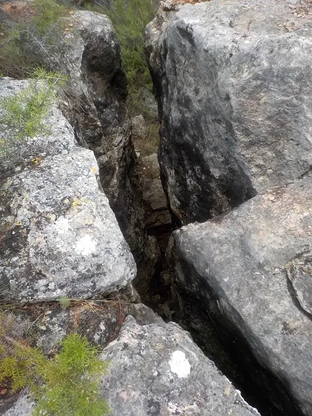
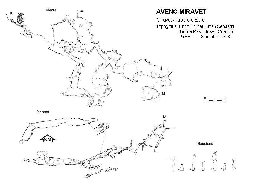
The E end of the fissure gives access to a series of ledges that are quite dangerous due to the instability of the rubble. At this point two routes begin. The route in an E direction follows a series of high-roofed joints, with various collapses, and after descending a -5 metre pit one reaches -34 metres of depth. The route in a W direction descends a -14 metre pit and, after a -2 metre ledge, accesses the point of maximum depth of the cavity, -43 metres. From here, climbing a +3 metre ledge, it goes a few metres further through narrow galleries oriented by the main fracture. On the W side of the fissure, a fig tree and some brambles mark the way to a -4 metre ledge that places one in a small chamber with no possibilities of continuation. Further on, descending a -3 metre ledge, one finds a gallery hanging at +4 metres that connects with the described route of the E sector. After the -3 metre ledge, a ramp leads to some narrow joints that lead to a super narrow 10 metre pit that links with one of the terminal galleries of the E sector. This entire sector is formed by a crossing of joints and fractures secondary to the main one.
Progressione
From the E end of the fissure a series of quite dangerous ledges are descended, due to the instability of the rubble on the ground. Having reached a point where two routes begin, the one that follows in an E direction is taken: a series of high-roofed joints, with various collapses, and after descending a -5 metre pit one reaches -34 metres of depth. By the other route, in a W direction, one must descend a -14 metre pit and, after a -2 metre ledge, access the point of maximum depth of the cavity, -43 metres. From here, climbing a +3 metre ledge, it goes a few metres further through narrow galleries oriented by the main fracture. On the W side of the fissure, a fig tree and some brambles mark the way to a -4 metre ledge that places one in a small chamber with no possibilities of continuation. Further on, descending a -3 metre ledge, one finds a gallery hanging at +4 metres that connects with the described route of the E sector. After the -3 metre ledge, a ramp leads to some narrow joints that lead to a super narrow 10 metre pit that links with one of the terminal galleries of the E sector.
Storia
The first reference to this cavity is found in the exploration carried out by the GE Badalona on 3 October 1998, who learned of the existence of this cavity through communication from some people who were participating in an outreach day held at the Can Palomeres mine (Malgrat de Mar).
In the same area, near the castle, members of SIRE – UEC Sants explored in September 1966 some fissures (Pits no. 1 and no. 2 of the Mola) of about 25 metres of depth and that a priori we might think would be the same phenomenon, but after consulting some old notes and a photo, we think that they are different cavities and that we leave them pending cataloguing.
Toponymy: Anvenc, is the word used by some inhabitants of the area when they speak of an avenc. Specifically it can be heard in Miravet and in the neighbouring village of Benissanet and even more in the area of Gandesa (Terra Alta).
Linguists consulted tell us that this derivation of avenc is simply an uneducated deformation of the correct name. That yes, it is said, but it is completely incorrect as a written expression.
Joan Coromines in his etymological dictionary does not mention this derivation, he does comment on others that we have been able to hear in some regions of Castelló and of similar origin to anvenc, such as for example: alvenc, in the area of Morella, Cinctorres,.. (els Ports) and a little further down, Sant Mateu, Tírig, Alcalà de Xivert, use a quite curious form that seems to change the gender of the word to the feminine: una venc, unes vencs.
Commenti degli utenti (0)
Nessun commento ancora.
Sii il primo a condividere la tua esperienza!
Esplorazioni registrate (0)
Nessuna esplorazione registrata.
Registra la tua visita a questa grotta!
Bibliografia
- Miret i Pérez, Francesc.(2005).- “Anvenc Miravet (Miravet, Ribera d'Ebre)”. Cavernes (25):37-39. GE Badalona.
- Fotografies de Lluisma extretes de Wikiloc (post del 15-11-2016).
Grotte vicine


Fonte: Espeleoindex (espeleoindex.com), modificato. CC BY-NC 4.0, https://creativecommons.org/licenses/by-nc/4.0/