
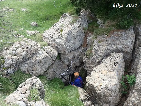
Avenc de les Pedres
A 78 m deep pit in the Rasets area (Castellar del Riu), explored in 1967 and identified in 2021 as the Avenc de les Pedres.
EspeleoWorld
Avenc de les Pedres
A 78 m deep pit in the Rasets area (Castellar del Riu), explored in 1967 and identified in 2021 as the Avenc de les Pedres.
Castellar del Riu · Berguedà
Sviluppo: 110 m · Profondità: 78 m
Scheda aggiornata
https://espeleoworld.com/it/c/avenc-de-les-pedres
Le informazioni possono cambiare. Verifica sempre coordinate, accesso, meteo e condizioni della cavità prima di partire.
A 78 m deep pit in the Rasets area (Castellar del Riu), explored in 1967 and identified in 2021 as the Avenc de les Pedres.
Topografia
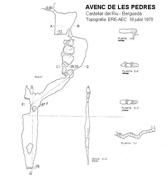
Espeleoindex · CC BY-NC 4.0, https://creativecommons.org/licenses/by-nc/4.0/ · Immagine © del suo autore.
Foto
Espeleoindex · CC BY-NC 4.0, https://creativecommons.org/licenses/by-nc/4.0/ · Immagine © del suo autore.
Descrizione
Morfologia
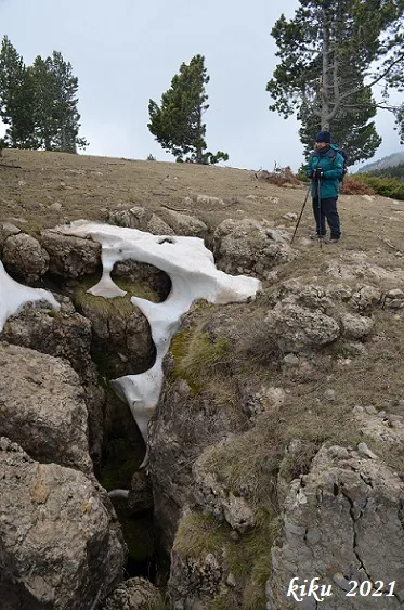
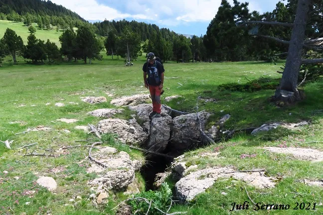
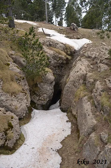
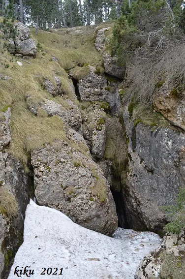
The mouth of the cavity opens in one of the terrain depressions (swallow holes) existing on the same level and which has caused the openings of other nearby pits and which in winter swallow a large quantity of water and snow.
The outer mouth gives access to the first chamber 12 m deep. 4 m are climbed up a steeply inclined ramp and a pit 4 m deep is found, by which one reaches the entrance of the second chamber, at 20 m depth. Along a corridor 16 m long, on a steep slope, with abrupt changes of direction and parallel walls, another very steep slope is found, 70º, giving access to the third chamber, of smaller dimensions than the others. In this one a pit 30 m deep opens, with dimensions 7 x 1 m, in the form of a fissure ending in a point and with the last 4 metres impassable. The descent is totally vertical.
The maximum depth of the cavity is 78 m with a length of 90 m.
Recently (June 2021) it has been possible to confirm that, through a narrow mouth opened in the depression, one enters a pit of about 10 m of drop. At its bottom, an ascending ramp leads to the very narrow mouth of a new pit that does not seem to be very deep, of dark appearance and with some blocks along its course. The walls of the cavity are very unstable and full of mud, which makes it difficult to rig with minimum safety. All this made them give up descending it.
Note: very probably the drop of the cavity is less than that indicated by the first explorers, especially if we take into account that all the topographic revisions of these cavities that have been made later have given a smaller drop.
Storia
Explored for the first time by the ERE of the AEC in May 1967, they return there in May 1970 to make the survey. In June 1969 members of the SIRE – UEC Sants locate it but do not explore it. At the mouth the name painted by its first explorers was still preserved.
In 2005 members of GE Badalona explore and survey again several cavities of the Rasets area, and to complicate things further these rename all the cavities with the initials “R”, in this case the name they assign to it is “R.1B de Rasets”, but they do not seem to identify it with the Avenc de les Pedres.
In June 2021, F. Rubinat and J. Serrano descend the first pit and confirm, by the first description and by a location sketch that the members of the ERE – AEC had published in 1972, that it is the Avenc de les Pedres which, for 50 years, had not been possible to identify.
Commenti degli utenti (0)
Nessun commento ancora.
Sii il primo a condividere la tua esperienza!
Esplorazioni registrate (0)
Nessuna esplorazione registrata.
Registra la tua visita a questa grotta!
Bibliografia
- Borràs, J; Miñarro, JM.; Talavera, F.(1980).-”l'Urgell, el Solsonès, la Segarra i el Berguedà”. Catàleg Espeleològic de Catalunya (vol.5):56-58. Ed. Políglota. Barcelona.
- Armendariz, Joan.(1979).-”Cim Estel·la 64”. Butll. Divul. Espeleol. (0):14-17. ERE-AE Catalunya. Barcelona
- Elias Balaña, Ferran.(1972).-”Exploración de los avencs de los Rassos de Peguera (Berga) y Pla d'Ardenya”. Comunicaciones 2º Simpos. Metodología espeleológica (monogràfic):VI-1/1-13. SIE.CE Àliga.
- Elias Balanyà, Ferran.(1979).-”Operació Cim Estel.la 70”. Butll. Divul. Espeleol. (0):122-133. ERE-AE Catalunya. Barcelona.
- Miñarro, J.M.(1970).-”Sobre algunos fenómenos espeleológicos desarrollados en els Rasets (Rasos de Peguera)”. Bol. Inf. SIRE (3):8-10. SIRE-UEC Sants. Barcelona.
- Valles, Jordi de.(2009).-”Berguedà, Cerdanya, Garrotxa, Ripollès”. Catàleg Espeleològic de Catalunya (vol.3):36-37. ECG-FCE.
- Coordenades, dades i fotografies facilitades per Juli Serrano (SIE-CEA) i Francesc Rubinat (ERE-CEC).
Grotte vicine


Fonte: Espeleoindex (espeleoindex.com), modificato. CC BY-NC 4.0, https://creativecommons.org/licenses/by-nc/4.0/