
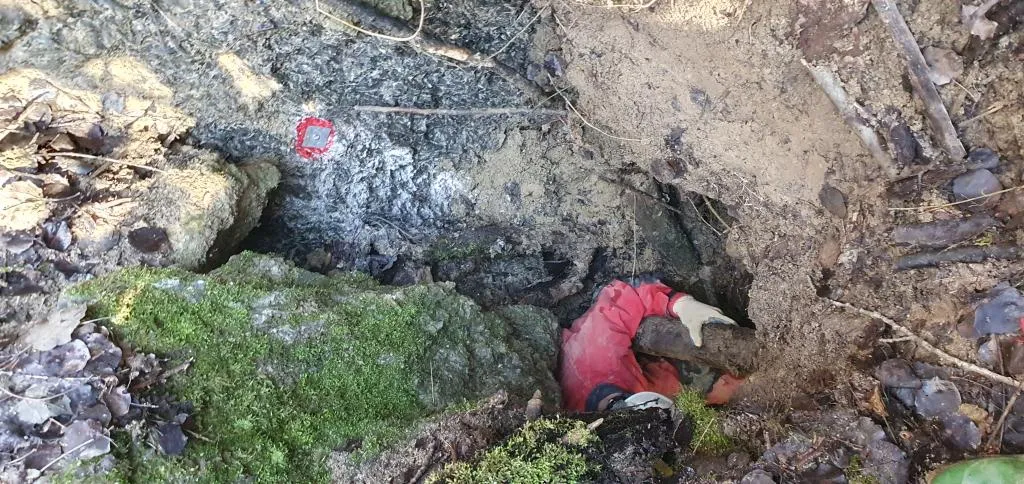
Inghiottitoio di Fondo Dolina di Goibola
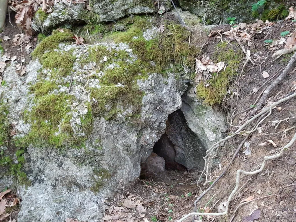
A swallow hole at the bottom of the Goibola Doline, with two adjacent entrances leading to a small chamber blocked by debris and large cobbles, with no passable routes downward.
EspeleoWorld
Inghiottitoio di Fondo Dolina di Goibola
A swallow hole at the bottom of the Goibola Doline, with two adjacent entrances leading to a small chamber blocked by debris and large cobbles, with no passable routes downward.
San Lazzaro di Savena
Länge: 19 m · Tiefe: 10 m
Aktueller Datensatz
https://espeleoworld.com/de/c/inghiottitoio-di-fondo-dolina-di-goibola-san-lazzaro-di-savena
Informationen können sich ändern. Koordinaten, Zugang, Wetter und Höhlenbedingungen vor dem Aufbruch immer prüfen.
A swallow hole at the bottom of the Goibola Doline, with two adjacent entrances leading to a small chamber blocked by debris and large cobbles, with no passable routes downward.
Topografie
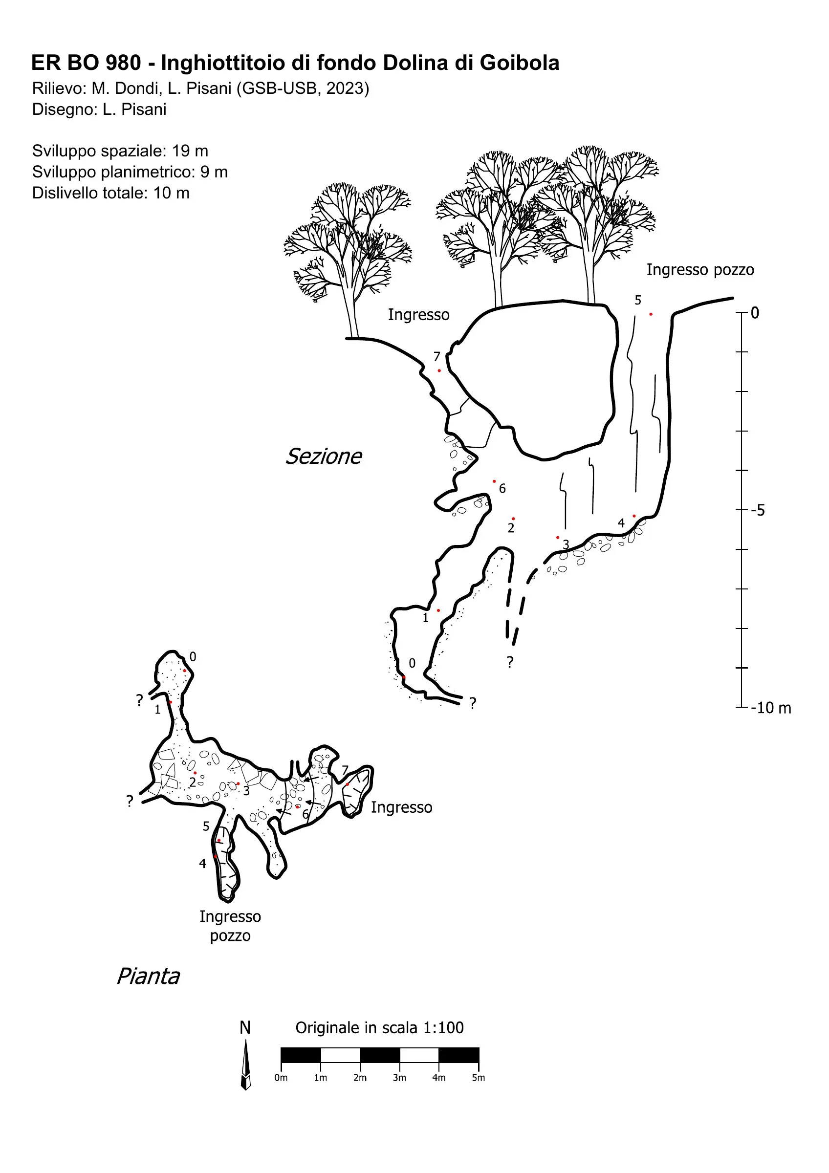

© Gruppo Speleologico Bolognese · CC BY-NC-SA 2.5 IT, https://creativecommons.org/licenses/by-nc-sa/2.5/it/ · Federazione Speleologica dell'Emilia-Romagna, http://www.fsrer.it · https://geo.regione.emilia-romagna.it/schede/speleo/index.jsp?id=980
Fotos

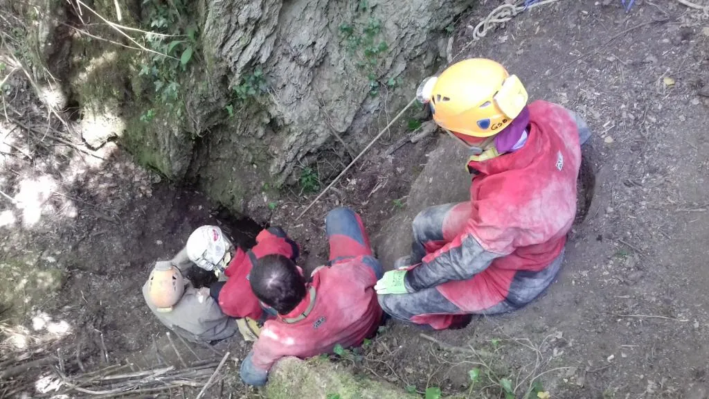
© Gruppo Speleologico Bolognese · CC BY-NC-SA 2.5 IT, https://creativecommons.org/licenses/by-nc-sa/2.5/it/ · Federazione Speleologica dell'Emilia-Romagna, http://www.fsrer.it · https://geo.regione.emilia-romagna.it/schede/speleo/index.jsp?id=980
Beschreibung
Morphologie
It has two adjacent entrances, one of which is a shaft, leading to a small chamber blocked by debris and large cobbles. No passable route downward has been identified, and any underlying pit is therefore considered completely blocked.
Befahrung
A single continuation route descends narrowly for a few metres on the right, then narrows until it becomes impassable.
Weitere Einzelheiten
Swallow hole registered by GSB-USB in 2020, although there are elements indicating it had already been descended previously without being documented in the cadastre. In the small chamber there are pressure nails, one of which is at the level of the cobble fill that forms the floor.
Benutzerkommentare (0)
Noch keine Kommentare.
Seien Sie der Erste, der seine Erfahrung teilt!
Registrierte Erkundungen (0)
Noch keine Erkundungen registriert.
Registrieren Sie Ihren Besuch in dieser Höhle!
Höhlen in der Nähe
Grotta della Santa
0.1 km · O
San Lazzaro di Savena
1 Topo.1 Fotos
Grotticella dell'Intelligenza ad Est della 878
0.1 km · SO
San Lazzaro di Savena
1 Topo.1 Fotos
Grotticella Greenpepper
0.1 km · SO
San Lazzaro di Savena
1 Topo.1 Fotos
Buca delle Mani Cucite
0.2 km · N
San Lazzaro di Savena
1 Topo.1 Fotos
Quelle: Catasto delle cavità naturali dell'Emilia-Romagna (Regione Emilia-Romagna, Federazione Speleologica Regionale dell'Emilia-Romagna) (servizigis.regione.emilia-romagna.it), verändert. CC BY 4.0, https://creativecommons.org/licenses/by/4.0/ Regione Emilia-Romagna, Catasto delle cavità naturali dell'Emilia-Romagna, Federazione Speleologica Regionale dell'Emilia-Romagna (FSRER) e i gruppi speleologici autori dei rilievi · Datenstand 2018 · Quelle: Catasto delle cavità naturali dell'Emilia-Romagna (Regione Emilia-Romagna, Federazione Speleologica Regionale dell'Emilia-Romagna) (servizigis.regione.emilia-romagna.it), verändert. CC BY-NC-SA 2.5 IT, https://creativecommons.org/licenses/by-nc-sa/2.5/it/ Federazione Speleologica dell'Emilia-Romagna, http://www.fsrer.it · Regione Emilia-Romagna, Catasto delle cavità naturali dell'Emilia-Romagna, e i gruppi speleologici autori dei rilievi · Datenstand 2018