

Wolfertschwendener Steige
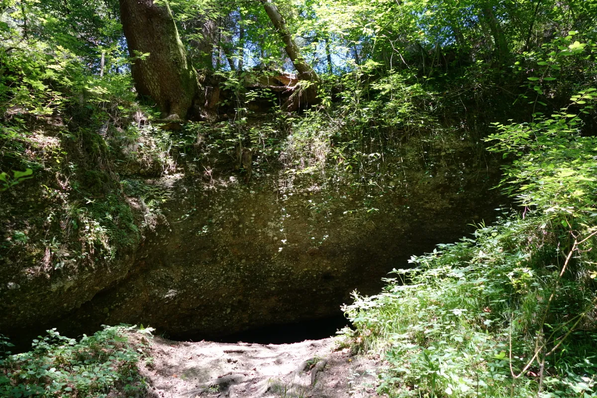
A 30-metre-long geotope exposure created by gravel extraction, with conglomerated gravels and geological organ pipes.
EspeleoWorld
Wolfertschwendener Steige
A 30-metre-long geotope exposure created by gravel extraction, with conglomerated gravels and geological organ pipes.
Wolfertschwenden
الطول: 30 m
السجل المحدّث
https://espeleoworld.com/ar/c/wolfertschwendener-steige-wolfertschwenden
قد تتغير المعلومات. تحقق دائمًا من الإحداثيات والوصول والطقس وظروف الكهف قبل الانطلاق.
A 30-metre-long geotope exposure created by gravel extraction, with conglomerated gravels and geological organ pipes.
الصور
© Mogadir · CC BY-SA 3.0, https://creativecommons.org/licenses/by-sa/3.0/ · Wikimedia Commons · https://commons.wikimedia.org/wiki/File:Wolfertschwender_Steige_09.JPG
الوصف
الشكل
The exposure extends over a length of 30 metres, a width of 10 metres and a height of 8 metres, covering an area of 300 square metres. On the quarry walls it shows conglomerated gravels and partly weakly developed geological organ pipes. The gravel of the geotope contains almost exclusively limestone and dolomite pebbles, which are poorly rounded. The cover gravel dates from the Early Pleistocene.
تفاصيل أخرى
The Wolfertschwendener Steige is a registered geotope with the number 778A002. The exposure was created by gravel extraction. The unprotected geotope, which was affected by remediation work on the district road in the early 2010s, is classified as geoscientifically significant and is only rarely present in the region.
تعليقات المستخدمين (0)
لا توجد تعليقات بعد.
كن أول من يشارك تجربته!
الاستكشافات المسجلة (0)
لا توجد استكشافات مسجلة بعد.
سجل زيارتك لهذا الكهف!
الكهوف القريبة

المصدر: Wikidata – cave items (Germany) (www.wikidata.org)، مع تعديلات. CC0 1.0, https://creativecommons.org/publicdomain/zero/1.0/ Wikidata (CC0 1.0) · بيانات عام 2026 · المصدر: German Wikipedia – article leads (cave descriptions) (de.wikipedia.org)، مع تعديلات. CC BY-SA 4.0, https://creativecommons.org/licenses/by-sa/4.0/ Wikipedia contributors (de.wikipedia.org), CC BY-SA 4.0 · النص بقلم Wikipedia contributors (Wolfertschwendener Steige) · عدّلته Espeleoworld (توحيد الصيغة، ترجمة)؛ التعديل مرخّص بموجب CC BY-SA 4.0, https://creativecommons.org/licenses/by-sa/4.0/ · الوصف · تم الحصول عليها في 2026-11-13 · https://de.wikipedia.org/wiki/Wolfertschwendener_Steige · بيانات عام 2026