
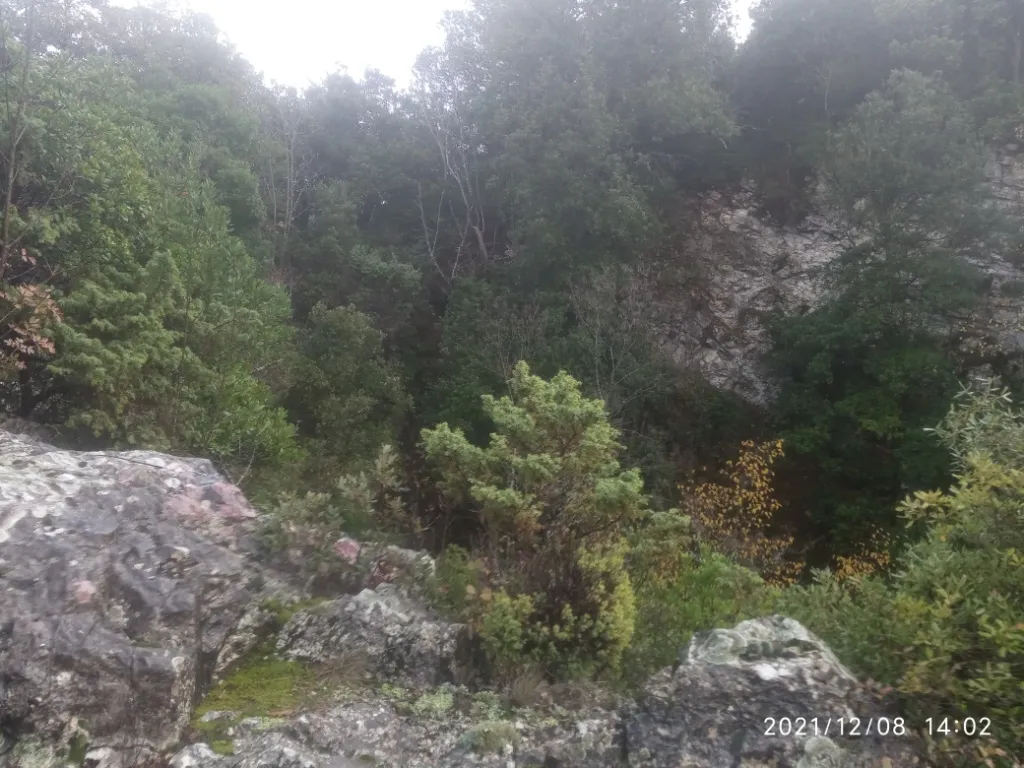
Vorgozzo
Enormous bottle-shaped collapse doline, with a surface diameter of about 25 m and a debris-covered bottom.
EspeleoWorld
Vorgozzo
Enormous bottle-shaped collapse doline, with a surface diameter of about 25 m and a debris-covered bottom.
Baschi
الطول: 72 m · العمق: 72 m
السجل المحدّث
https://espeleoworld.com/ar/c/vorgozzo-baschi-terni
قد تتغير المعلومات. تحقق دائمًا من الإحداثيات والوصول والطقس وظروف الكهف قبل الانطلاق.
Enormous bottle-shaped collapse doline, with a surface diameter of about 25 m and a debris-covered bottom.
الصور

© Mauro Barbieri · LicenseRef-FUGS-media-per-item · Federazione Umbra Gruppi Speleologici (FUGS), Catasto Speleologico dell'Umbria · https://catasto.fugs.it/index.php?mod=caves&op=view&id=11
الوصف
الشكل
Enormous collapse doline with a surface diameter of about 25 m, bottle-shaped. The longer horizontal axis of the bottom is oriented N-S. At the bottom there is an imposing debris accumulation.
التقدم
Orientation: vertical. Passability: demanding; recommended period all year round. Rigging: necessary. Progression difficulty: shafts. Hazards: dangerous access, landslides/collapses. Descending from the lowest side, after 10 mt on a ledge on the wall, a fully free-hanging vertical of 51 m for a total drop of 72 m.
تفاصيل أخرى
Geology: MAI Maiolica - Upper Jurassic-Lower Cretaceous (Tithonian-Aptian); stratified micritic limestones.
التاريخ
Notes on the name: referred to as Voragine Vittoria or Vorgozzo at Civitella de’ Pazzi by Lippi Boncambi (1950).
تعليقات المستخدمين (0)
لا توجد تعليقات بعد.
كن أول من يشارك تجربته!
الاستكشافات المسجلة (0)
لا توجد استكشافات مسجلة بعد.
سجل زيارتك لهذا الكهف!
المراجع
LIPPI BONCAMBI C. (1950) Sullo stato attuale del Catasto Speleologico dell'Umbria LEMMI G. (1958) Note di aggiornamento del Catasto Speleologico dell'Umbria ANGELUCCI A. & COCOZZA T. (1961) La serie stratigrafica del Pozzo del Vorgozzo LEMMI G. & COLETTI G. (1961) Elenco catastale delle grotte dell'Umbria ANGELUCCI A. & COCOZZA T. (1962) Cenni di geologia del Monte Cerrentino e studio stratigrafico del pozzo del Vorgozzo (Orvieto) ANONIMO (1962) Attività del Gruppo Grotte dell'Istituto di Geologia dell'Università di Perugia VIVIANI C.G. (1971) L'attività del gruppo Speleologico C.A.I. Perugia nel 1970 PIRRAMI M.M. (1972) Attività 1971 del Gruppo Speleologico Todi
الكهوف القريبة
المصدر: Catasto Cavità Umbria (Federazione Umbra Gruppi Speleologici, FUGS) (catasto.fugs.it)، مع تعديلات. LicenseRef-FUGS-no-licence-stated Federazione Umbra Gruppi Speleologici (FUGS), Catasto Speleologico dell'Umbria · https://catasto.fugs.it/index.php?mod=caves&op=view&id=11 · بيانات عام 2025 · المصدر: Catasto Cavità Umbria (Federazione Umbra Gruppi Speleologici, FUGS) (catasto.fugs.it)، مع تعديلات. LicenseRef-FUGS-media-per-item Federazione Umbra Gruppi Speleologici (FUGS), Catasto Speleologico dell'Umbria · بيانات عام 2025