
Räuber Daneil Höhle
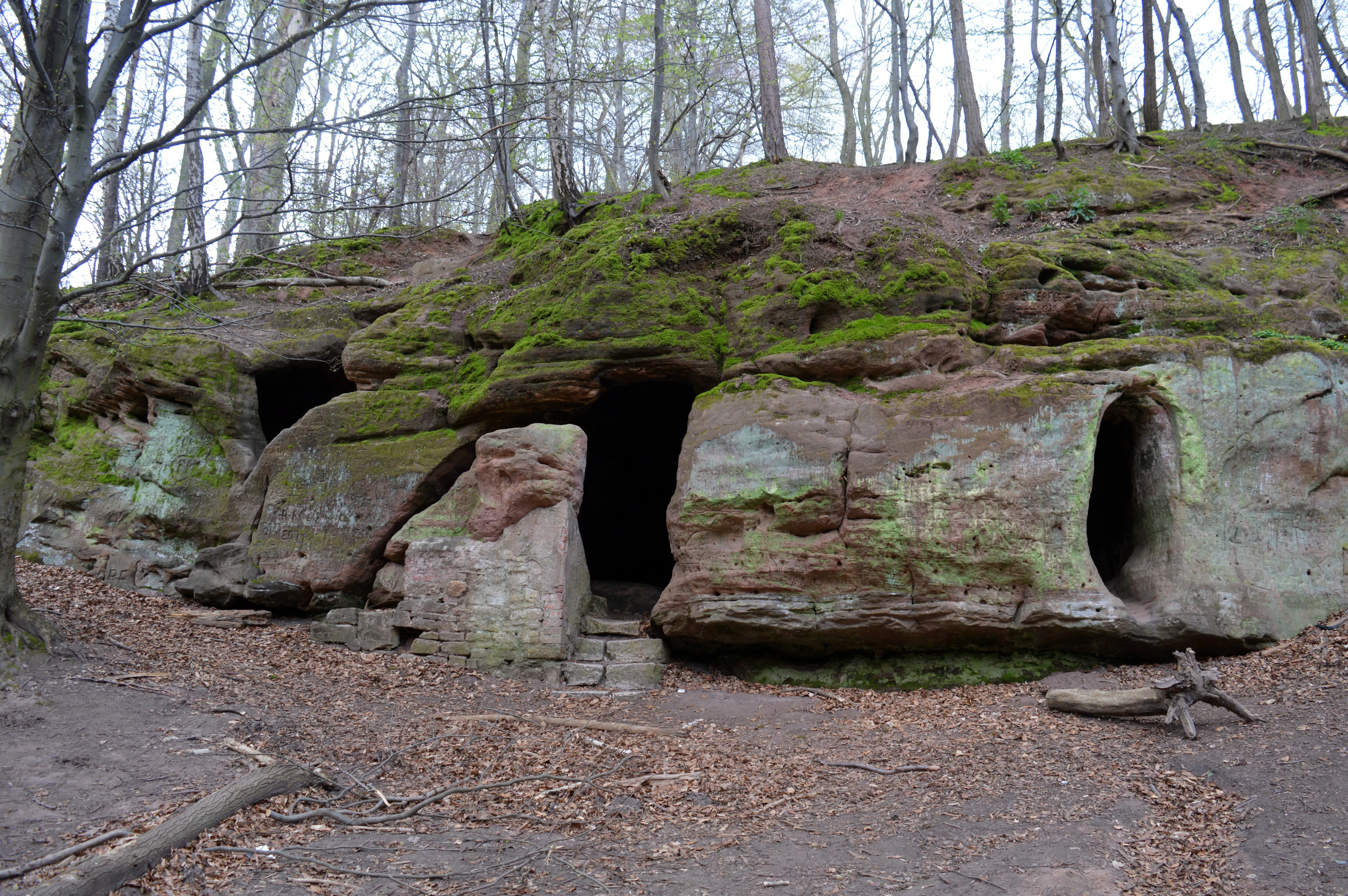
The Daneilshöhle, also called Räuberhöhle, consists of three interconnected, protected cavities in a rock face of the Middle Buntsandstein.
EspeleoWorld
Räuber Daneil Höhle
The Daneilshöhle, also called Räuberhöhle, consists of three interconnected, protected cavities in a rock face of the Middle Buntsandstein.
Huy
السجل المحدّث
https://espeleoworld.com/ar/c/raeuber-daneil-hoehle-huy
قد تتغير المعلومات. تحقق دائمًا من الإحداثيات والوصول والطقس وظروف الكهف قبل الانطلاق.
The Daneilshöhle, also called Räuberhöhle, consists of three interconnected, protected cavities in a rock face of the Middle Buntsandstein.
الصور

© Ragnar1904 · CC BY-SA 4.0, https://creativecommons.org/licenses/by-sa/4.0/ · Wikimedia Commons · https://commons.wikimedia.org/wiki/File:Landschaftsschutzgebiet_Huy_-_Daneilsh%C3%B6hle_(2).JPG
الوصف
الشكل
In a rock face of the Middle Buntsandstein, the Daneilshöhle forms three interconnected cavities that are protected. Holes for barrier beams and vertical walls indicate that the Daneilshöhle was enlarged by human hand.
تفاصيل أخرى
The cavities evidently originated through washing out in the Tertiary or in the Ice Age, that is, they are of geological origin.
التاريخ
It is said to have served in the Middle Ages as a hermit's cell and in the early modern period possibly also as a shelter for highwaymen and robbers. In the criminal trial against Simon Bingelhelm of Halberstadt, who was called Tausendteufel and who was executed in June 1600 for murder and other deeds, it is named as the scene of the crime.
تعليقات المستخدمين (0)
لا توجد تعليقات بعد.
كن أول من يشارك تجربته!
الاستكشافات المسجلة (0)
لا توجد استكشافات مسجلة بعد.
سجل زيارتك لهذا الكهف!
الكهوف القريبة
يحتوي على معلومات من © OpenStreetMap contributors، www.openstreetmap.org، متاحة بموجب رخصة قاعدة البيانات المفتوحة (Open Database License، ODbL 1.0, https://opendatacommons.org/licenses/odbl/1-0/)، مع تعديلات. · https://www.openstreetmap.org/node/457859732 · بيانات عام 2026 · المصدر: Wikidata – cave items (Germany) (www.wikidata.org)، مع تعديلات. CC0 1.0, https://creativecommons.org/publicdomain/zero/1.0/ Wikidata (CC0 1.0) · الأسماء · تم الحصول عليها في 2026-11-13 · بيانات عام 2026 · المصدر: German Wikipedia – article leads (cave descriptions) (de.wikipedia.org)، مع تعديلات. CC BY-SA 4.0, https://creativecommons.org/licenses/by-sa/4.0/ Wikipedia contributors (de.wikipedia.org), CC BY-SA 4.0 · النص بقلم Wikipedia contributors (Daneilshöhle) · عدّلته Espeleoworld (توحيد الصيغة، ترجمة)؛ التعديل مرخّص بموجب CC BY-SA 4.0, https://creativecommons.org/licenses/by-sa/4.0/ · الوصف · تم الحصول عليها في 2026-11-13 · https://de.wikipedia.org/wiki/Daneilsh%C3%B6hle · بيانات عام 2026 · البيانات المشتقة متاحة عند الطلب بموجب ODbL: [email protected]