
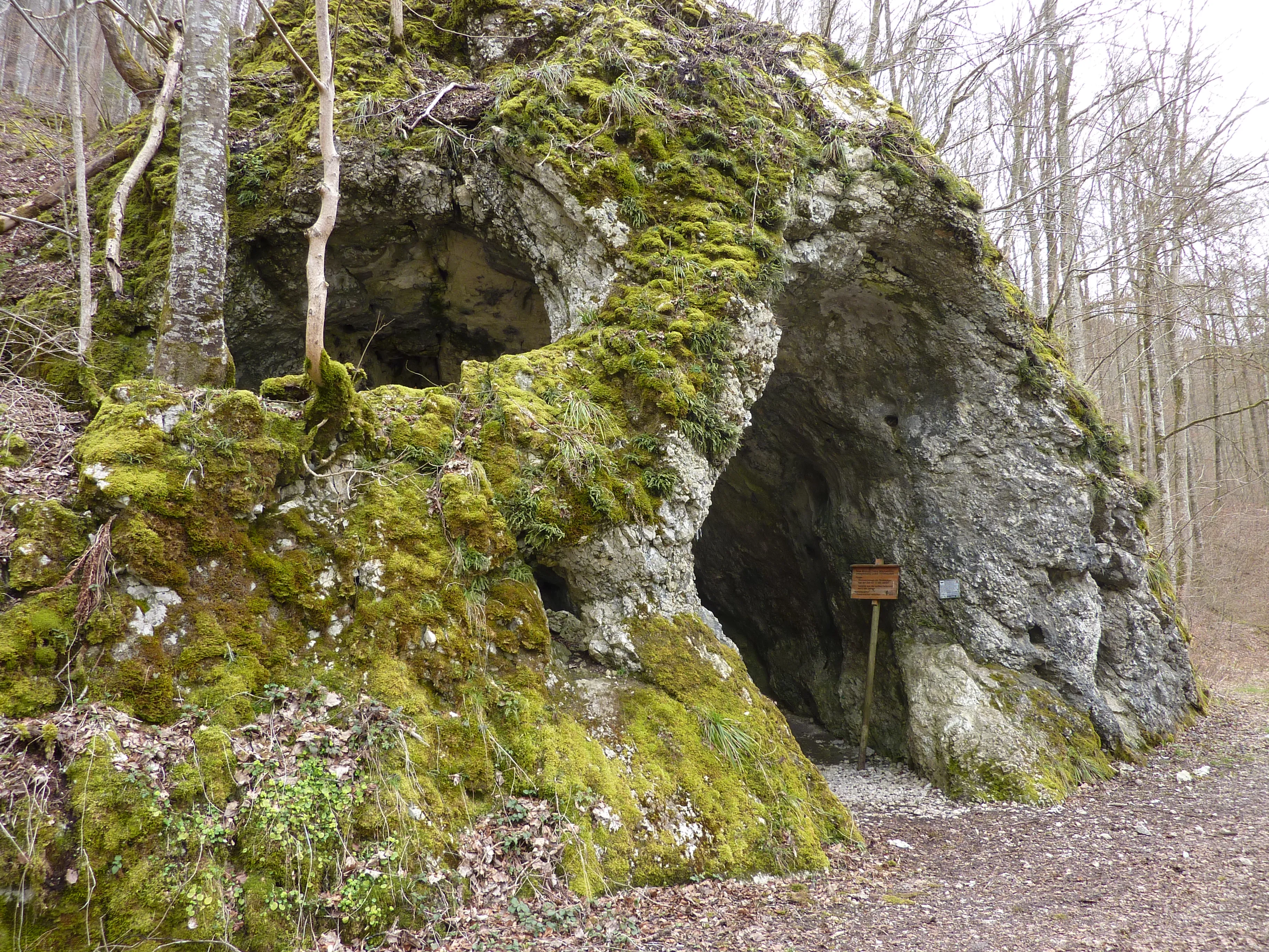
Maurushöhle
The Rote-Brunnen-Höhle is a Höhlensystem (cave system) consisting of three passages with an explored length of 376 metres, whose longest passage is walled up after ten metres to protect the bats.
EspeleoWorld
Maurushöhle
The Rote-Brunnen-Höhle is a Höhlensystem (cave system) consisting of three passages with an explored length of 376 metres, whose longest passage is walled up after ten metres to protect the bats.
Leibertingen
العمق: 376 m
السجل المحدّث
https://espeleoworld.com/ar/c/maurushoehle-leibertingen
قد تتغير المعلومات. تحقق دائمًا من الإحداثيات والوصول والطقس وظروف الكهف قبل الانطلاق.
The Rote-Brunnen-Höhle is a Höhlensystem (cave system) consisting of three passages with an explored length of 376 metres, whose longest passage is walled up after ten metres to protect the bats.
الصور
© Manuel Heinemann · CC BY-SA 3.0, https://creativecommons.org/licenses/by-sa/3.0/ · Wikimedia Commons · https://commons.wikimedia.org/wiki/File:Rote-Brunnen-H%C3%B6hle.jpg
الوصف
الشكل
The Höhlensystem (cave system) consists of three passages. The longest passage is walled up after ten metres to protect the bats and thereafter has only a passage for the bats. The cave has an explored length of 376 metres.
الترسبات الكهفية
The middle of the passages ends in a dripstone cave.
المياه
The cave's namesake is the Rote Brunnen, a spring that rises from the hillside scree below the cave about two metres above the water level of the Danube. The spring has a mean discharge of 50 litres per second (minimum 25, maximum 675 l/s). At high discharge, water also emerges from the cave.
تفاصيل أخرى
The cave is protected as a natural monument and designated as a geotope. In winter it may not be entered to protect the bats.
التاريخ
Finds indicate early use by Stone Age hunters. In the 1960s it was planned to use the spring for water supply. The plans were abandoned after marking experiments established that water sinking in the Wildensteiner Tal east of the castle flows very rapidly to the Rote Brunnen.
تعليقات المستخدمين (0)
لا توجد تعليقات بعد.
كن أول من يشارك تجربته!
الاستكشافات المسجلة (0)
لا توجد استكشافات مسجلة بعد.
سجل زيارتك لهذا الكهف!
الكهوف القريبة


المصدر: Geotopkataster Baden-Württemberg (Regierungspräsidium Freiburg – LGRB) (services.lgrb-bw.de)، مع تعديلات. Data licence Germany – attribution – version 2.0 (dl-de/by-2-0), https://www.govdata.de/dl-de/by-2-0 Datenquelle: Regierungspräsidium Freiburg - LGRB, www.lgrb-bw.de · بيانات عام 2026 · يحتوي على معلومات من © OpenStreetMap contributors، www.openstreetmap.org، متاحة بموجب رخصة قاعدة البيانات المفتوحة (Open Database License، ODbL 1.0, https://opendatacommons.org/licenses/odbl/1-0/)، مع تعديلات. · العمق, الأسماء · تم الحصول عليها في 2026-11-13 · https://www.openstreetmap.org/node/294924180 · بيانات عام 2026 · المصدر: Wikidata – cave items (Germany) (www.wikidata.org)، مع تعديلات. CC0 1.0, https://creativecommons.org/publicdomain/zero/1.0/ Wikidata (CC0 1.0) · بيانات عام 2026 · المصدر: German Wikipedia – article leads (cave descriptions) (de.wikipedia.org)، مع تعديلات. CC BY-SA 4.0, https://creativecommons.org/licenses/by-sa/4.0/ Wikipedia contributors (de.wikipedia.org), CC BY-SA 4.0 · النص بقلم Wikipedia contributors (Rote-Brunnen-Höhle) · عدّلته Espeleoworld (توحيد الصيغة، ترجمة)؛ التعديل مرخّص بموجب CC BY-SA 4.0, https://creativecommons.org/licenses/by-sa/4.0/ · الوصف · تم الحصول عليها في 2026-11-13 · https://de.wikipedia.org/wiki/Rote-Brunnen-H%C3%B6hle · بيانات عام 2026 · البيانات المشتقة متاحة عند الطلب بموجب ODbL: [email protected]