
Jungfernhöhle
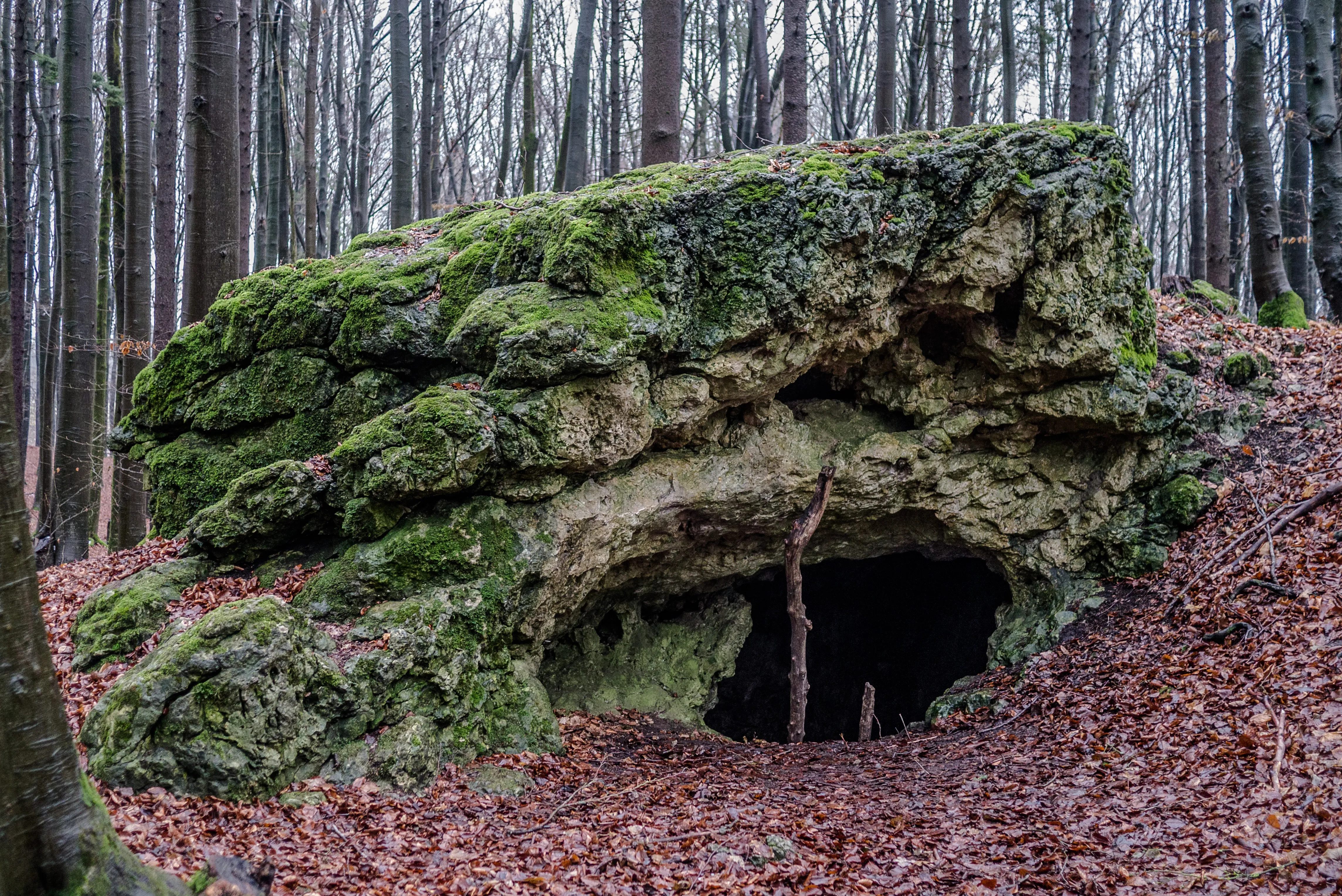
The Jungfernhöhle is a natural karst cave near Tiefenellern in the Upper Franconian municipality of Litzendorf in the district of Bamberg in Bavaria, open to the west.
EspeleoWorld
Jungfernhöhle
The Jungfernhöhle is a natural karst cave near Tiefenellern in the Upper Franconian municipality of Litzendorf in the district of Bamberg in Bavaria, open to the west.
Litzendorf
الطول: 10 m
السجل المحدّث
https://espeleoworld.com/ar/c/jungfernhoehle-litzendorf
قد تتغير المعلومات. تحقق دائمًا من الإحداثيات والوصول والطقس وظروف الكهف قبل الانطلاق.
The Jungfernhöhle is a natural karst cave near Tiefenellern in the Upper Franconian municipality of Litzendorf in the district of Bamberg in Bavaria, open to the west.
الصور
© ermell · CC BY-SA 3.0, https://creativecommons.org/licenses/by-sa/3.0/ · Wikimedia Commons · https://commons.wikimedia.org/wiki/File:Jungfernh%C3%B6hle-1020485.jpg
الوصف
الشكل
The Jungfernhöhle is a natural karst cave. It is open to the west.
تفاصيل أخرى
The Jungfernhöhle is registered in the Franconian Alb cave register (HFA) as C 238 and by the Bavarian State Office for the Environment as geotope 471H001. See also the list of geotopes in the district of Bamberg.
التاريخ
The cave was, among other things, a Neolithic cult site of the Linear Pottery culture.
تعليقات المستخدمين (0)
لا توجد تعليقات بعد.
كن أول من يشارك تجربته!
الاستكشافات المسجلة (0)
لا توجد استكشافات مسجلة بعد.
سجل زيارتك لهذا الكهف!
الكهوف القريبة


المصدر: Geotopkataster Bayern (Bayerisches Landesamt für Umwelt) (www.umweltatlas.bayern.de)، مع تعديلات. CC BY 4.0, https://creativecommons.org/licenses/by/4.0/ Datenquelle: Bayerisches Landesamt für Umwelt, www.lfu.bayern.de · https://www.umweltatlas.bayern.de/mapapps/resources/reports/sb_geotope/generateBericht.pdf?additionallayerfieldvalue=471H001 · بيانات عام 2026 · المصدر: Wikidata – cave items (Germany) (www.wikidata.org)، مع تعديلات. CC0 1.0, https://creativecommons.org/publicdomain/zero/1.0/ Wikidata (CC0 1.0) · الطول, الأسماء · تم الحصول عليها في 2026-11-13 · بيانات عام 2026 · المصدر: German Wikipedia – article leads (cave descriptions) (de.wikipedia.org)، مع تعديلات. CC BY-SA 4.0, https://creativecommons.org/licenses/by-sa/4.0/ Wikipedia contributors (de.wikipedia.org), CC BY-SA 4.0 · النص بقلم Wikipedia contributors (Jungfernhöhle) · عدّلته Espeleoworld (توحيد الصيغة، ترجمة)؛ التعديل مرخّص بموجب CC BY-SA 4.0, https://creativecommons.org/licenses/by-sa/4.0/ · الوصف · تم الحصول عليها في 2026-11-13 · https://de.wikipedia.org/wiki/Jungfernh%C3%B6hle · بيانات عام 2026