
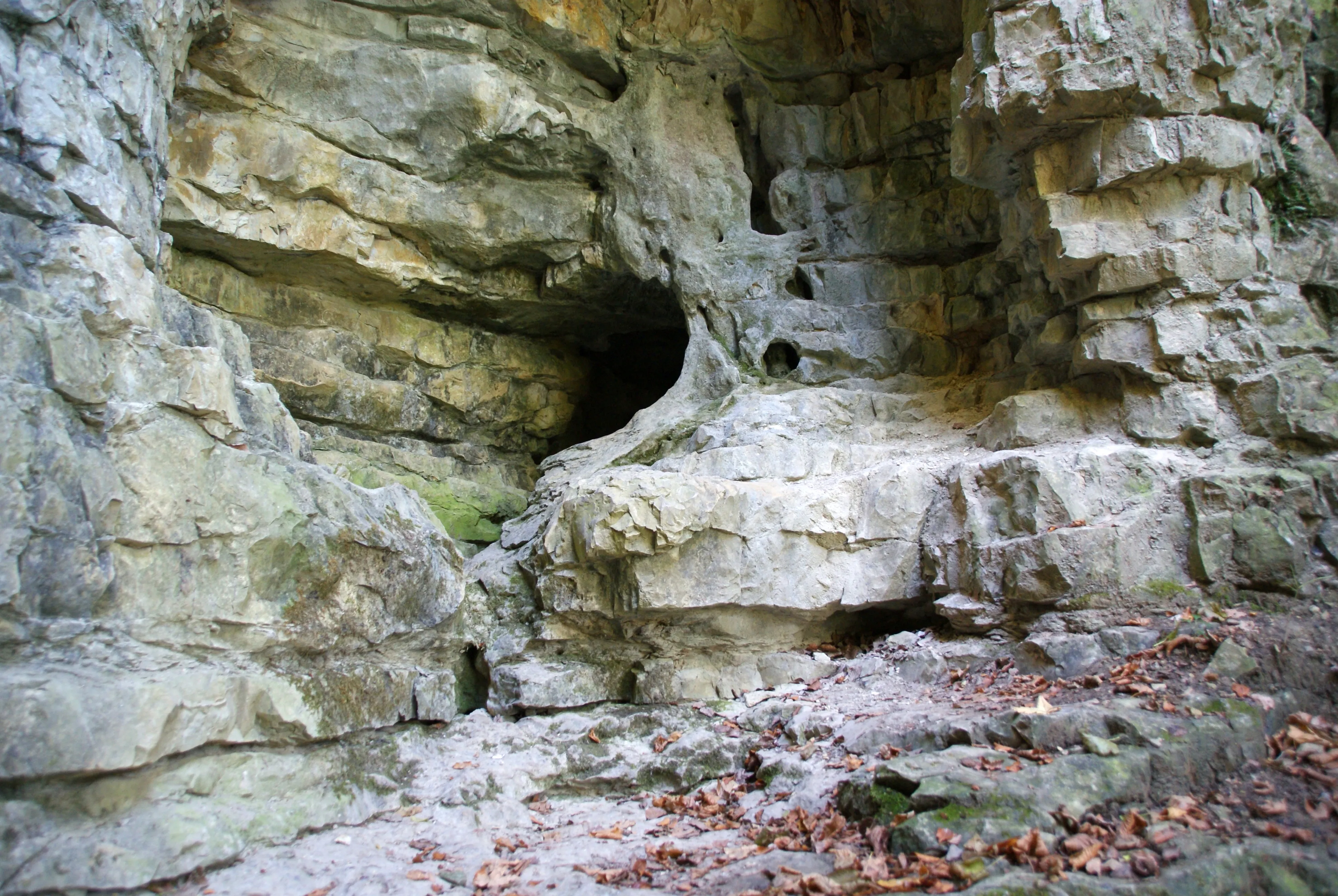
Höhle Bauerloch
The Bauerloch is a karst cave on the northern escarpment of the Swabian Alb.
EspeleoWorld
Höhle Bauerloch
The Bauerloch is a karst cave on the northern escarpment of the Swabian Alb.
Neuffen
السجل المحدّث
https://espeleoworld.com/ar/c/hoehle-bauerloch-neuffen
قد تتغير المعلومات. تحقق دائمًا من الإحداثيات والوصول والطقس وظروف الكهف قبل الانطلاق.
The Bauerloch is a karst cave on the northern escarpment of the Swabian Alb.
الصور

© Karle3 · CC BY-SA 4.0, https://creativecommons.org/licenses/by-sa/4.0/ · Wikimedia Commons · https://commons.wikimedia.org/wiki/File:Bauerloch-Hoehle-20161016-00527.jpg
الوصف
المياه
During heavy rain and at snowmelt, the Dürrenbach springs from the entrance of the Bauerloch, and large parts of the cave are then completely under water. In dry periods the stream emerges only at about 520 m above sea level in the lower part of the Tales.
التقدم
For this reason, entering the cave is dangerous.
تفاصيل أخرى
The Bauerloch is protected as a geotope under the number 13634/934 and, under the name Bauerlochhöhle und Magerrasen im Gewann Bauerlochberg with the protected area number 811-60462912, also as a natural monument.
تعليقات المستخدمين (0)
لا توجد تعليقات بعد.
كن أول من يشارك تجربته!
الاستكشافات المسجلة (0)
لا توجد استكشافات مسجلة بعد.
سجل زيارتك لهذا الكهف!
الكهوف القريبة
المصدر: Geotopkataster Baden-Württemberg (Regierungspräsidium Freiburg – LGRB) (services.lgrb-bw.de)، مع تعديلات. Data licence Germany – attribution – version 2.0 (dl-de/by-2-0), https://www.govdata.de/dl-de/by-2-0 Datenquelle: Regierungspräsidium Freiburg - LGRB, www.lgrb-bw.de · بيانات عام 2026 · يحتوي على معلومات من © OpenStreetMap contributors، www.openstreetmap.org، متاحة بموجب رخصة قاعدة البيانات المفتوحة (Open Database License، ODbL 1.0, https://opendatacommons.org/licenses/odbl/1-0/)، مع تعديلات. · الأسماء · تم الحصول عليها في 2026-11-13 · https://www.openstreetmap.org/node/759770645 · بيانات عام 2026 · المصدر: Wikidata – cave items (Germany) (www.wikidata.org)، مع تعديلات. CC0 1.0, https://creativecommons.org/publicdomain/zero/1.0/ Wikidata (CC0 1.0) · بيانات عام 2026 · المصدر: German Wikipedia – article leads (cave descriptions) (de.wikipedia.org)، مع تعديلات. CC BY-SA 4.0, https://creativecommons.org/licenses/by-sa/4.0/ Wikipedia contributors (de.wikipedia.org), CC BY-SA 4.0 · النص بقلم Wikipedia contributors (Bauerloch) · عدّلته Espeleoworld (توحيد الصيغة، ترجمة)؛ التعديل مرخّص بموجب CC BY-SA 4.0, https://creativecommons.org/licenses/by-sa/4.0/ · الوصف · تم الحصول عليها في 2026-11-13 · https://de.wikipedia.org/wiki/Bauerloch · بيانات عام 2026 · البيانات المشتقة متاحة عند الطلب بموجب ODbL: [email protected]