
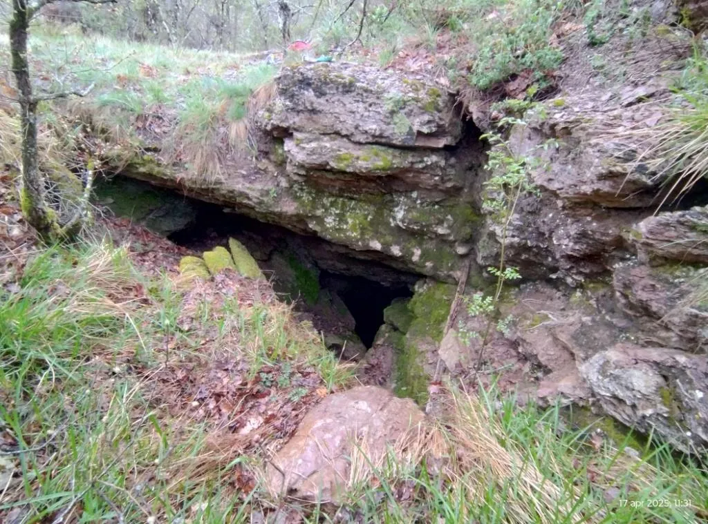
Grotta di Fontana Miella
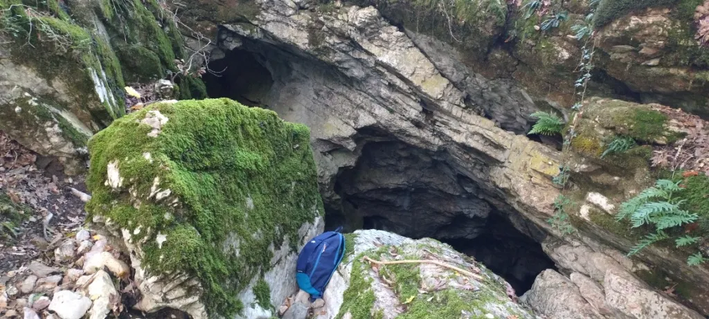
Cave that opens with a wide swallow hole about 2x2 m in a landslide gully and continues with an 18 m pit, from the bottom of which a system of fissures and wide galleries is reached.
EspeleoWorld
Grotta di Fontana Miella
Cave that opens with a wide swallow hole about 2x2 m in a landslide gully and continues with an 18 m pit, from the bottom of which a system of fissures and wide galleries is reached.
San Venanzo
الطول: 77 m · العمق: 33 m
السجل المحدّث
https://espeleoworld.com/ar/c/grotta-di-fontana-miella-san-venanzo-terni
قد تتغير المعلومات. تحقق دائمًا من الإحداثيات والوصول والطقس وظروف الكهف قبل الانطلاق.
Cave that opens with a wide swallow hole about 2x2 m in a landslide gully and continues with an 18 m pit, from the bottom of which a system of fissures and wide galleries is reached.
الطبوغرافيا
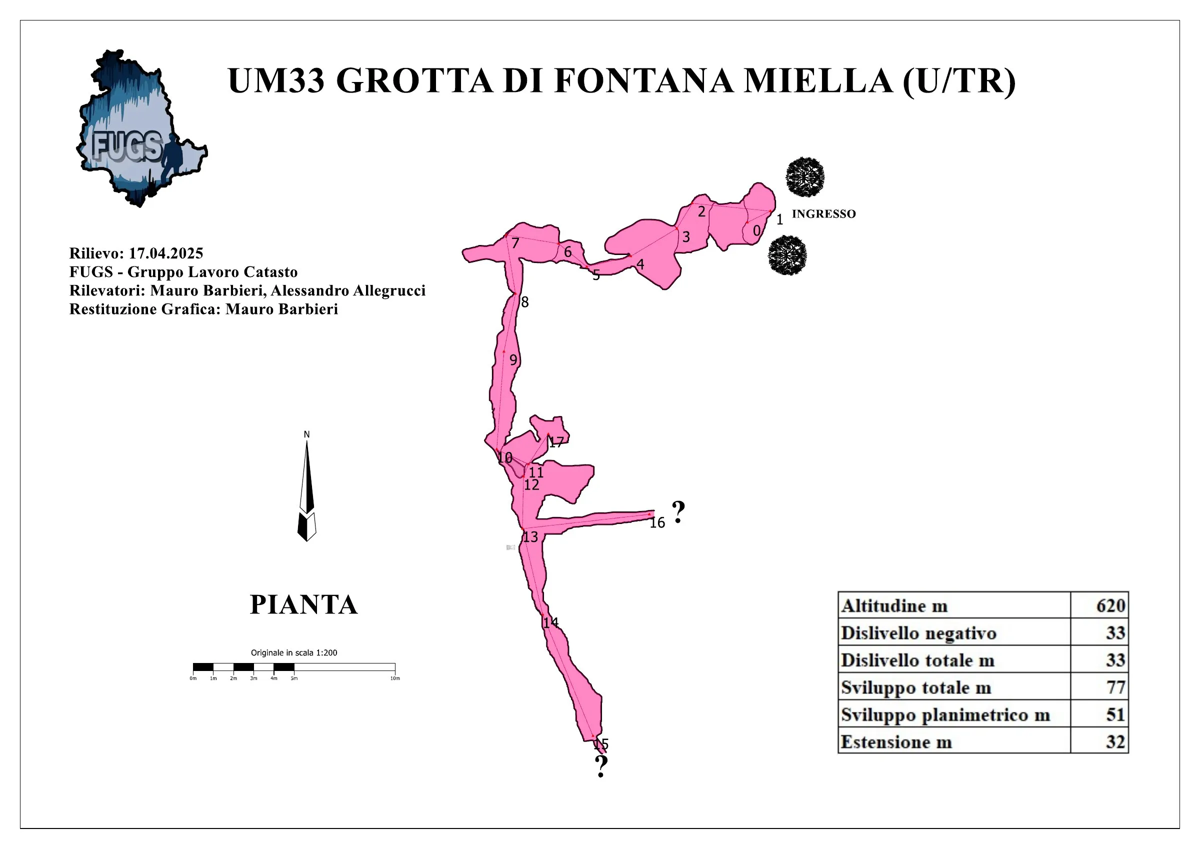
© Mauro Barbieri · CC BY-SA 4.0, https://creativecommons.org/licenses/by-sa/4.0/ · Federazione Umbra Gruppi Speleologici (FUGS), Catasto Speleologico dell'Umbria · https://catasto.fugs.it/index.php?mod=caves&op=view&id=33
الصور
© Mauro Barbieri · LicenseRef-FUGS-media-per-item · Federazione Umbra Gruppi Speleologici (FUGS), Catasto Speleologico dell'Umbria · https://catasto.fugs.it/index.php?mod=caves&op=view&id=33
الوصف
الشكل
Entrance: wide swallow hole inside a landslide gully, about 2x2 m in size. 18 m pit, from the bottom of which a system of fissures and wide galleries is reached. Trend: mixed.
المياه
Water difficulties: waterfalls.
التقدم
Passability: experts only; recommended period all year round. Rigging: fixed. Hazards: dangerous access, landslides/collapses.
تفاصيل أخرى
Geology: VAS Scaglia Variegata - Eocene Med.Sup. (Lutetian-Priabonian); marls; stratified.
التاريخ
Notes on the name: it presumably takes its name from a gully near the Fosso di Ospedaletto close to the entrance.
تعليقات المستخدمين (0)
لا توجد تعليقات بعد.
كن أول من يشارك تجربته!
الاستكشافات المسجلة (0)
لا توجد استكشافات مسجلة بعد.
سجل زيارتك لهذا الكهف!
المراجع
LEMMI G. & COLETTI G. (1961) Elenco catastale delle grotte dell'Umbria ANONIMO (1962) Attività del Gruppo Grotte dell'Istituto di Geologia dell'Università di Perugia COCCHI C. (1962) La Grotta di Fontana Miella MARTINI A. (1962) Alcune considerazioni preliminari sulla microflora delle caveme ANONIMO (1972) Il 1971 per Io Speleo Club di Orvieto
الكهوف القريبة


المصدر: Catasto Cavità Umbria (Federazione Umbra Gruppi Speleologici, FUGS) (catasto.fugs.it)، مع تعديلات. LicenseRef-FUGS-no-licence-stated Federazione Umbra Gruppi Speleologici (FUGS), Catasto Speleologico dell'Umbria · https://catasto.fugs.it/index.php?mod=caves&op=view&id=33 · بيانات عام 2025 · المصدر: Catasto Cavità Umbria (Federazione Umbra Gruppi Speleologici, FUGS) (catasto.fugs.it)، مع تعديلات. LicenseRef-FUGS-media-per-item Federazione Umbra Gruppi Speleologici (FUGS), Catasto Speleologico dell'Umbria · بيانات عام 2025