
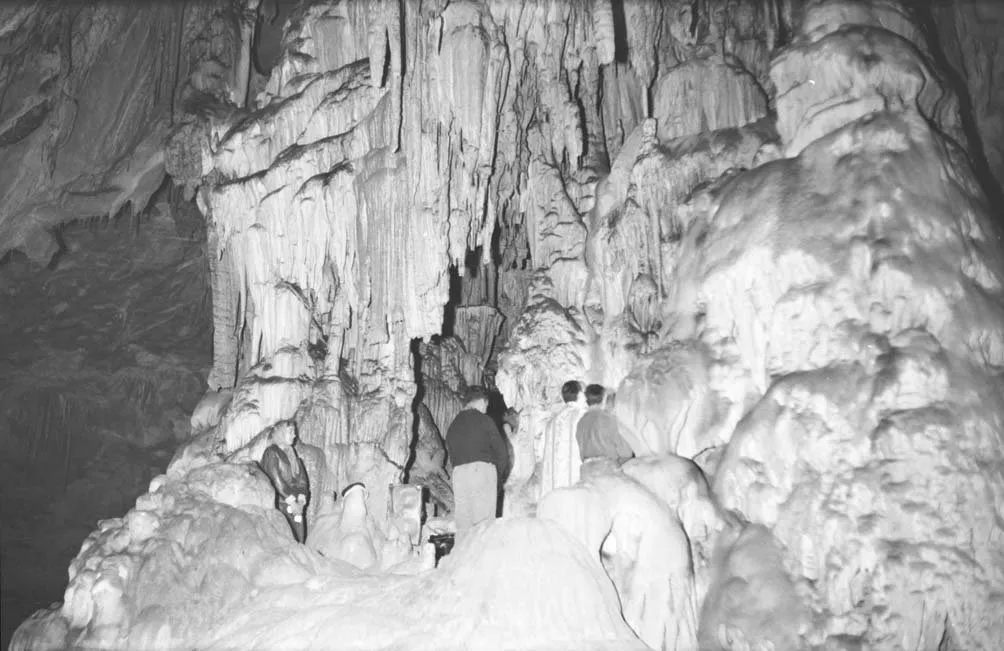
Cuevas de Mairuelegorreta
The cuevas de Mairuelegorreta open in the Gorbeia massif, in Zigoitia (Álava), within the Gorbeia Natural Park. They have more than 12 km of galleries and about 215 m of vertical extent.
EspeleoWorld
Cuevas de Mairuelegorreta
The cuevas de Mairuelegorreta open in the Gorbeia massif, in Zigoitia (Álava), within the Gorbeia Natural Park. They have more than 12 km of galleries and about 215 m of vertical extent.
Zigoitia
الطول: 18088 m · العمق: 215 m
السجل المحدّث
https://espeleoworld.com/ar/c/cuevas-de-mairuelegorreta-zigoitia
قد تتغير المعلومات. تحقق دائمًا من الإحداثيات والوصول والطقس وظروف الكهف قبل الانطلاق.
The cuevas de Mairuelegorreta open in the Gorbeia massif, in Zigoitia (Álava), within the Gorbeia Natural Park. They have more than 12 km of galleries and about 215 m of vertical extent.
الصور
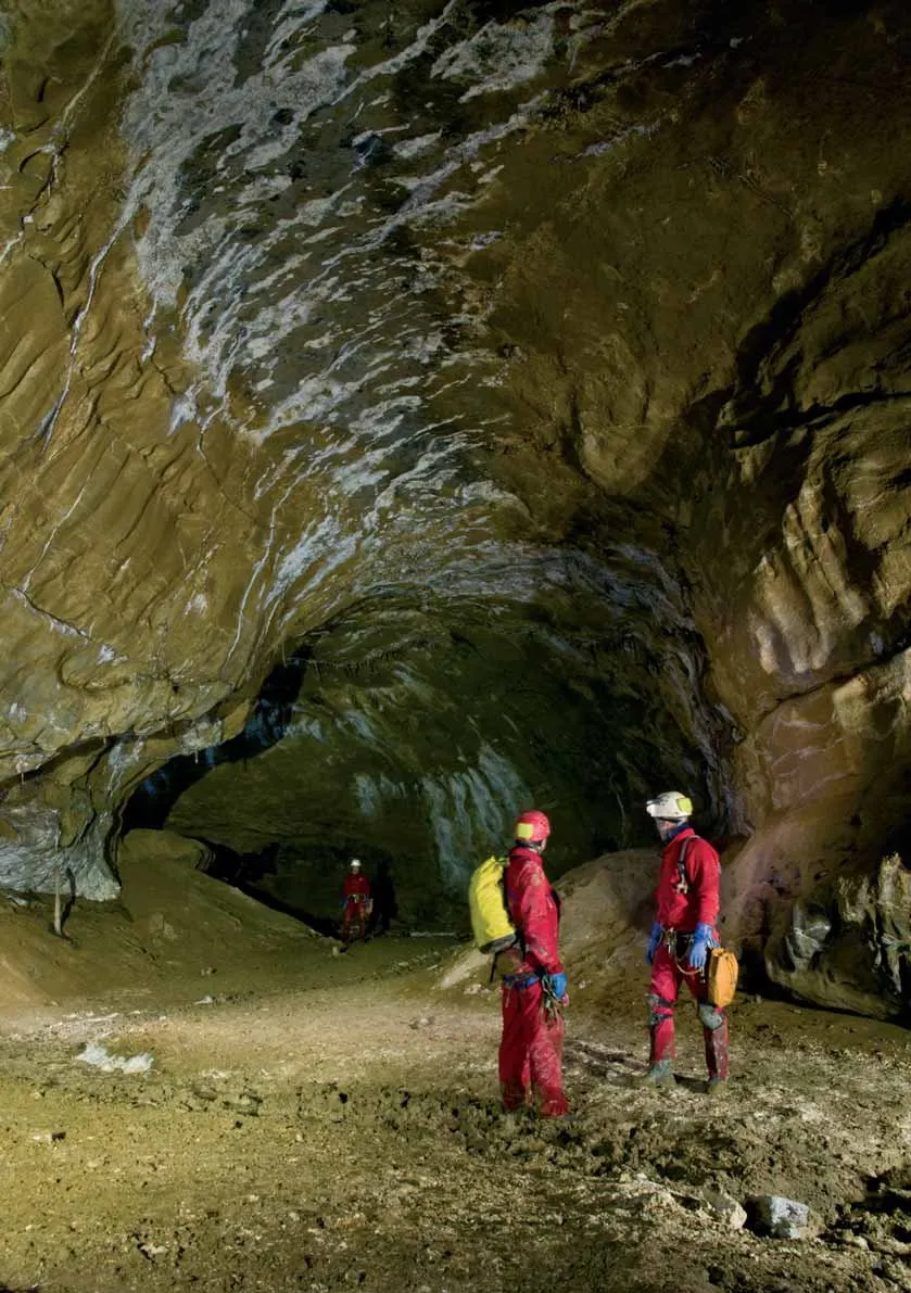
© Juan San Martin · CC-BY-SA-3.0 3.0 · Juan San Martin, CC BY-SA 3.0, via Wikimedia Commons · https://commons.wikimedia.org/wiki/File%3A9956_o.jpg
الوصف
الشكل
The rock is blue limestone from the Cenomanian, up to 70 m thick. It has a regular dip of 21 degrees to the southwest and very intense fracturing.
The escarpment has three mouths. Mouth I, in the center, is the main one, 7.40 m wide and 3 m high. Mouth III is the highest and mouth II the lowest. A fourth, upper mouth was found in 2006 and was connected with the interior after a climb of about 30 m. The main entrance leads to a straight 70 m stretch with sunlight, followed by an artificial staircase.
The best-known chambers are these. The Calle de la Estación measures 9.40 m by 5 m and ends in the Plaza de Toros, a semicircular chamber 25 to 27 m in diameter and about 20 m high. Peña Grande is about 150 x 45 x 20 m and takes its name from a block of more than 1000 tonnes.
The cave is mostly horizontal and has few verticals. It is organized in three levels according to the 1958 plan and in five according to the tourist sheet. Las Capillas are at +36 m and are the highest point. The sima Madi reaches -90 m. The Pozo del Diablo, 20 m deep, was overcome with a climb in January 1959 and leads to the Jardín del Diablo.
الترسبات الكهفية
The cave has suffered significant damage: it is one of the most affected in Álava by broken stalactites, graffiti and rubbish. Even so, it preserves notable formations. Las Capillas are two chambers preceded by a portico, with large concretions; to reach them you have to climb a stalagmitic ramp with gours. In the Museo del Prado, a 10 m joint-shaft, there are eccentric formations 1 m high.
المياه
Mairuelegorreta is part of the system that drains the entire southeast slope of the Gorbea. Its water outlets are the springs of Artxegi and Sale el Agua. Asunkorta, Dulao and Pagoluzieta belong to the same system. The cave mouths are old resurgences that today lie above the active network.
A subterranean river flows inside. Its water appears at the spring of Artzegi, next to the Zubialde river, and part of it is used to supply Vitoria-Gasteiz. A dye tracing with fluorescein in July 1959 confirmed it. The dye also appeared in the Errekaseku river and in the reservoirs.
Upstream is the Sifón Rubio. In 1959 an attempt was made to pass it in apnea (more than 8 m) and in 1992 with bottles, but it is too narrow. The sumps of Mairuelegorreta and Pagoluzieta are separated by a little more than 100 m. The Errekaseku, 8 km long, runs parallel. The cave of Peña Gingia, in the Garbea quarry, is not connected and belongs to the Sale el Agua spring.
التقدم
The time needed depends on the objective. A short visit to Peña Grande and the calle de San Ildefonso required about 2 hours in 2018. Traversing the main galleries takes several days. In 1987 the GEA located a labyrinth of joints at several levels, with heights of up to 17 m.
تفاصيل أخرى
The published lengths have been growing: 9300 m in 1962, 10000 m in 1964 and 12340 m in 1968, with 210 m of vertical extent. The most recent figure, from Grottocenter in 2026, is 18088 m and 215 m of vertical extent.
The Plaza de Toros has hosted the Euskal Jaia festival since 21 July 1963, which brought together more than 2000 people. Since 1990 an annual folklore festival has been held there in September. According to Basque mythology, the cave is the dwelling of the goddess Mairu, also called Mari. There is also a legend about a buried treasure.
Rescue drills were held in 1973, 1976 and 1991, and there were at least seven fall accidents, the last in 2004. In 2007 a competition was called to adapt the cave for tourism, which was suspended at the end of that year.
التاريخ
Around 1906-1907 Luis Heintz explored the cave over three days and drew a sketch with more than 2 km of galleries. The first explorers, Isidoro Fernández and Carlos Peyres, gave galleries and chambers the names of streets and squares of the Vitoria of 1900. In 1949 the doctor Francisco Hernández leased it for 25 years to exploit it for tourism.
In August 1958 the GEMI, directed by Armando Llanos, carried out a seven-day campaign. In 1959 the cave already had 9 km and 210 m of vertical extent. The GEA was founded in 1962 from the GEMI and the CADIE, and since then it has directed the explorations. In 1986 a detailed survey began, coordinated by Félix Alangua.
الأحياء
The cave is a Quaternary site. Remains of ancient cave bear (Ursus deningeri), cave bear and brown bear have been found, with 15 nests and 16 claw marks on the walls. There are also remains of aurochs, steppe bison, lynx, cave lion, rhinoceros, wolf and deer.
Alavasoma muniesai is a white millipede 12 mm long, first described in this cave.
تعليقات المستخدمين (0)
لا توجد تعليقات بعد.
كن أول من يشارك تجربته!
الاستكشافات المسجلة (0)
لا توجد استكشافات مسجلة بعد.
سجل زيارتك لهذا الكهف!
الكهوف القريبة

يحتوي على معلومات من Grottocenter (Wikicaves)، grottocenter.org، متاحة بموجب رخصة قاعدة البيانات المفتوحة (Open Database License، ODbL 1.0, https://opendatacommons.org/licenses/odbl/1-0/)، مع تعديلات. · https://grottocenter.org/ui/entrances/168712 · بيانات عام 2026 · المصدر: Grottocenter (Association Wikicaves), worldwide collaborative cave database (grottocenter.org)، مع تعديلات. CC BY-SA 3.0, https://creativecommons.org/licenses/by-sa/3.0/ Grottocenter (Wikicaves) · النص بقلم Biboc (Cuevas de Mairuelegorreta) · https://grottocenter.org/ui/entrances/168712 · بيانات عام 2026 · نص كتبه Espeleoworld استنادًا إلى مصادر عامة. يُرجى استئذاننا قبل إعادة استخدامه. · النص بقلم Grottocenter (Mairuelegorreta (Cuevas de) - Grottocenter entrance 168712), Wikipedia (eu) (Mairuelegorreta), Wikipedia (es) (Cueva de Mairuelegorreta), Sección de Espeleología de la Excursionista Manuel Iradier de Vitoria (Notas sobre la Cueva de Mairuelegorreta), Jesús M. Lz. de Ipiña (Mairuelegorreta (historia de la exploración), Pyrenaica 235), Cavitats Subterrànies (blog) (Cueva de Mairuelegorreta (Macizo de Gorbea, Álava)), Macizo de Gorbeia (blog) (Cueva de Mairuelegorreta), Arabaturismo (Diputación Foral de Álava) (Cuevas de Mairuelegorreta), Wikipedia (es) (Parque natural del Gorbea), Wikidata (Wikidata Q12262867 (Mairuelegorreta)), Wikimedia Commons (Category:Mairuelegorreta (Wikimedia Commons)) · عدّلته Espeleoworld (توحيد الصيغة، ترجمة)؛ التعديل مرخّص بموجب Our own text, written from public sources. Please ask us before reusing it. · البيانات المشتقة متاحة عند الطلب بموجب ODbL: [email protected]